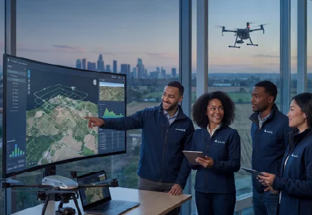
Spatial data has become an important resource for infrastructure management, public safety, surveying, and low-altitude operations. Yet collecting aerial imagery and geographic information is only the first step. Organizations must also reconstruct environments, identify relevant objects, interpret spatial relationships, and turn analysis results into practical decisions. Spatial artificial intelligence (AI) brings these stages closer together, helping professional teams organize complex geospatial workflows and make better use of the information they collect.
Building a Reliable Foundation with 3D Reconstruction
The workflow begins with collecting suitable spatial data. Unmanned aerial vehicles (UAVs), cameras, and other surveying equipment can capture overlapping images of buildings, terrain, transport networks, and industrial sites. Photogrammetry uses image relationships to derive three-dimensional information, provided that image coverage, camera characteristics, positioning data, and processing quality are appropriate. The U.S. Geological Survey documents how photogrammetric methods can generate point clouds, elevation models, and orthomosaics from aerial imagery.
AI 3D reconstruction extends this foundation by combining computer vision and reconstruction techniques to create digital representations of physical environments. Depending on the data and method, outputs may include textured 3D meshes, point clouds, and orthomosaics. These formats serve different purposes: meshes represent surface geometry, point clouds preserve spatial measurements, and orthomosaics provide geometrically corrected aerial views.
However, reconstruction quality depends on more than the processing algorithm. Image overlap, lighting, surface texture, positioning accuracy, and occlusion can affect the results. Professional teams should establish data-quality criteria before collection and validate reconstructed outputs against project requirements.
Connecting Spatial Intelligence Solutions Across the Workflow
Once spatial data has been reconstructed, the next task is to extract information that supports a defined operational objective. Traditional workflows may require staff to switch between mapping software, image viewers, spreadsheets, and reporting tools. Each handoff can introduce delays, duplicated work, or inconsistencies between datasets.
Well-designed spatial intelligence solutions connect data preparation, reconstruction, AI-based interpretation, and the delivery of analytical results. Rather than treating a 3D model as the final deliverable, teams can use it as a foundation for identifying objects, locating features, and examining their spatial relationships.
This integration does not eliminate the need for professional review. Different projects require different coordinate systems, classification rules, accuracy thresholds, and output formats. Clear interfaces between workflow stages help teams identify where data originates, how it has been processed, and whether the resulting information is suitable for its intended use.
Turning Visual Information into Measurable Findings
Computer vision helps convert large image collections into structured information. Depending on the model and task, AI can classify image content, detect specified objects, or assign semantic labels to individual pixels. Geospatial platforms can then represent findings as mapped features for further analysis. Esri’s documentation describes these techniques and their application to imagery-based GIS workflows.
For infrastructure managers, this process may help identify visible assets or locate features requiring closer inspection. Emergency response teams may use mapped objects and reconstructed terrain to improve their understanding of an incident area. Surveying professionals can compare spatial outputs with existing records to investigate discrepancies.
AI 3D reconstruction becomes more useful when its outputs are linked to relevant attributes and geographic coordinates. A detected object is more actionable when analysts can determine where it is, what category it belongs to, and how it relates to surrounding structures. Confidence scores and human verification can also help teams evaluate uncertain results before operational use.
From Analysis Results to Operational Decisions
The value of spatial AI depends on how effectively its outputs support real decisions. A detection result alone may not tell an asset manager whether a site needs further inspection. Teams must interpret findings alongside project records, operating procedures, environmental conditions, and other relevant evidence.
Spatial intelligence solutions can support this process by organizing mapped features, measurements, and visual context into outputs that decision-makers can review. For example, infrastructure teams may prioritize field inspections based on the location and condition of visible assets. Emergency planners may combine reconstructed scenes with incident information to assess access routes and identify areas requiring attention.
The final decision should remain tied to the reliability of the underlying evidence. Analysts need to understand model limitations, review ambiguous findings, and distinguish observed conditions from AI-generated interpretations. This approach makes spatial analysis more practical without treating algorithmic results as definitive judgments.
Applying End-to-End Spatial AI in Professional Environments
Integrating collection, reconstruction, and analysis is particularly relevant when organizations manage large areas or time-sensitive operations. At Icecypress Technology, the technology portfolio spans 3D reconstruction, UAV mapping, and spatial AI, with applications in infrastructure, mapping, inspection, and emergency response. Its DroneSwarm system focuses on onboard analysis and multi-UAV collaboration, while TrackSight supports target tracking and analytics.
These capabilities illustrate how AI 3D reconstruction can fit into a broader operational process rather than functioning as an isolated modeling task. The appropriate configuration depends on the mission, available equipment, data volume, communications conditions, and required deliverables.
For B2B buyers, evaluating a platform therefore involves more than comparing model detail or processing speed. Procurement teams should examine supported data formats, integration requirements, deployment environments, validation procedures, and the level of technical support available. Pilot projects can help establish whether the workflow meets operational and regulatory needs before wider implementation.
Building a More Connected Decision-Making Process
Spatial AI is most valuable when it connects reliable data collection with meaningful interpretation and practical action. By combining photogrammetry, 3D modeling, computer vision, and geospatial analysis, organizations can reduce fragmented processing and create a clearer path from raw imagery to decision-ready information.
For companies exploring spatial intelligence solutions, the priority should be a workflow that fits their actual operational requirements, with transparent data quality checks and appropriate human oversight. Icecypress Technology‘s work across reconstruction, UAV mapping, and spatial analysis provides one example of this integrated approach. The long-term objective is not simply to produce richer visual models, but to make spatial information more useful for professional planning, inspection, and response.
